North Cyprus Geography
Cyprus is the third largest island in the Mediterranean after Sardinia and Sicily. It lies 65 km from Turkey's southern coast. Other neighbouring countries are Syria (97 km), Lebanon (108 km), Egypt (370 km), Israel and Greece. Since the division of Cyprus in 1974 the Turkish Cypriots have lived in the northern part of the island while Greek Cypriots live in the south.
Mainly the effects of side pressures have formed the island's present shape during different geological ages. 'Capes' have been formed where the land has strength against the erosion of the sea and 'Gulfs' have been formed where the land was weaker and so gave way to erosion. There are two capes, Zafer Cape at the end of the Karpaz peninsula and Korucam Cape to the west. The two gulfs are at Guzelyurt and Famagusta.
Area
The total area of the island is approximately 9,252 sq km, but North Cyprus covers a total area of 3,515 sq km or nearly one third of the whole island. It is some 242 km wide and 64 km deep approximately at its extreme points.
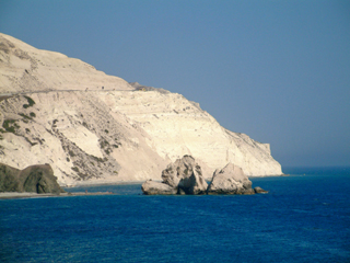
Coastline
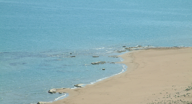
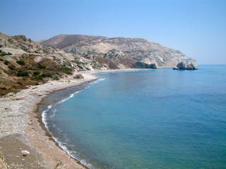
The coastline consists of enchanting coves, rocky coast and long golden sandy beaches. The beaches of Northern Cyprus are among the cleanest and safest in the Mediterranean. The average water temperature is 24C between May and October. The summer season sees the Hotel Beaches offering an excellent service to its customers in terms of eating and drinking facilities, not failing to mention the provision of beach umbrellas and beach loungers. Some of the beaches of Norhern Cyprus will also offer activities such as water skiing, banana rides, jet-ski, wind surfing and scuba diving.
Mountains
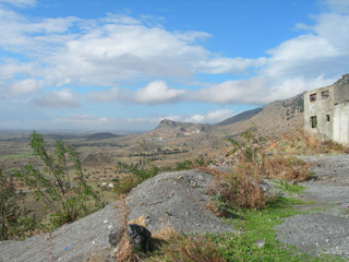
The most prominent feature of Norht Cyprus is the northern range of mountains, known as the Kyrenia Mountains, or Five Finger Mountains. It is a narrow range, approximately 130 km long, running parallel to the coastline. Occupying an area of about 260 sq km, it is composed predominately of limestone, dolomite, and marble. The highest point is Mount Selvili, near village of Lapta, at 1,023 m.
The largest spring in the North Cyprus is in this range near Five Finger Mountains. The fertile north coast is chiefly covered with olive and carob trees.
Plains and Lowlands
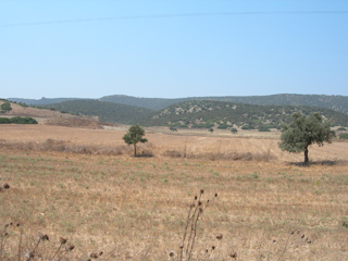
The Mesaoria plain, which lies in the centre of the island, between the Kyrenia Mountains and the Troodos Mountains in the south, is used for the production of central crops such as wheat, barley and oats. It is known as the breadbasket of Cyprus.
Sea and Shore
The northern and eastern shores of North Cyprus are lapped by the clear, blue, warm waters of the Mediterranean. All along the coastline are bays and beaches where swimming and sunbathing can take place the whole year round. The largest bays are Guzelyurt and Famagusta and main peninsulas are Zafer, Korucam and Kasa.
Earthquakes
Cyprus is located in the palm of what is known as the Cyprian Arc.
Unfortunately the exact location of the Cyprian Arc is still under
debate. It seems that each time that a study is conducted, different
results emerge. It has reached the point that people do not even
know what type of fault the Cyprian Arc is.